
July Outlook
By Rick Thoman
Alaska Climate Specialist
Alaska Center for Climate Assessment and Preparedness
International Arctic Research Center/University of Alaska Fairbanks
The July outlook from NOAA’s Climate Prediction Center for western Alaska favors neither above nor below normal temperatures. Remember, this does not mean that near normal is likely— it means that it could equally go either way.
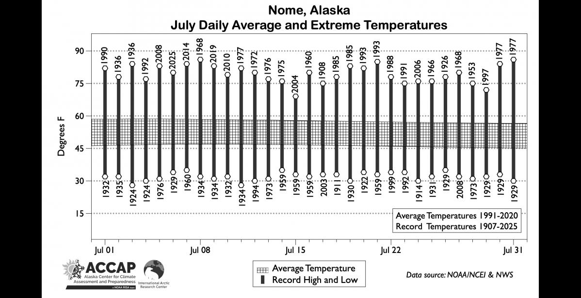
Rainfall is slightly favored to be above normal for the Seward Peninsula but neither above nor below normal is favored for eastern Norton Sound coast and St. Lawrence Island. For reference, the average July temperature at Nome is 52°F. Over the past 118 years July temperatures have ranged from 86°F in 1977 to a low of 28°F in 1924 and 1934. Subfreezing temperatures are uncommon on the coast in July, with the last occurrence at the Nome Airport in 2011.
July also marks the start of the July-September late summer “rainy season.” In the past 15 years, most Julys have had significantly more rain than the long-term average, and three of the five wettest Julys in Nome’s long climate history have happened since 2012. Of course, not every recent July has been rainy. In the past decade both 2018 and 2020 had much less rain than normal.
While July precipitation is not changing much in most of Alaska, western Alaska is a big exception with a significant increase in rainfall since the 1970s all across the region.
Snow is uncommon in July at low elevations though happens occasionally right in the Bering Strait, and occasionally, in the lower slopes of the Kigluiak and Bendeleben Mountains.