

Mild and wet start to November
By Rick Thoman
Alaska Climate Specialist
Alaska Center for Climate Assessment and Preparedness
International Arctic Research Center/University of Alaska Fairbanks
Through the first week of November the climate themes for western Alaska have been “mild” and “wet.”
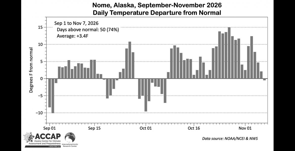
For Nome airport, the average temperatures and total precipitation since September 1 are both in the top ten warmest/wettest. With temperatures, this week's Climate Watch graphic illustrates just how persistent the comparatively mild temperatures have been, including 30 consecutive days that were above 1991-2020 daily normal.
Looking at winds in the upper atmosphere helps explains what's happened. Over the past ten weeks, on average, low pressure aloft has been dominated over the southwest Bering Sea and high pressure has been anchored over the north Pacific Ocean, south of eastern Aleutians and Alaska Peninsula. The result has been an enhanced storm track from southwest to northeast through the Bering Sea and into the Chukchi Sea.
However, since Halloween the weather pattern has changed, with the storm track now more tracking west-to-east along the Aleutian Islands and then into the Gulf of Alaska. This is a common impact of El Niño, with a stronger jet stream across the northern central Pacific, and most of the time only the dissipating remains of weather fronts are able to reach the northern Bering Sea region, bringing at most light amounts of snow. And being on the north side of the storm track means that temperatures will trend down and allow rivers to more consistently freeze and sea ice to start to form.